
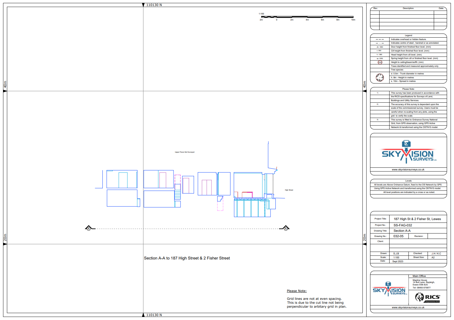
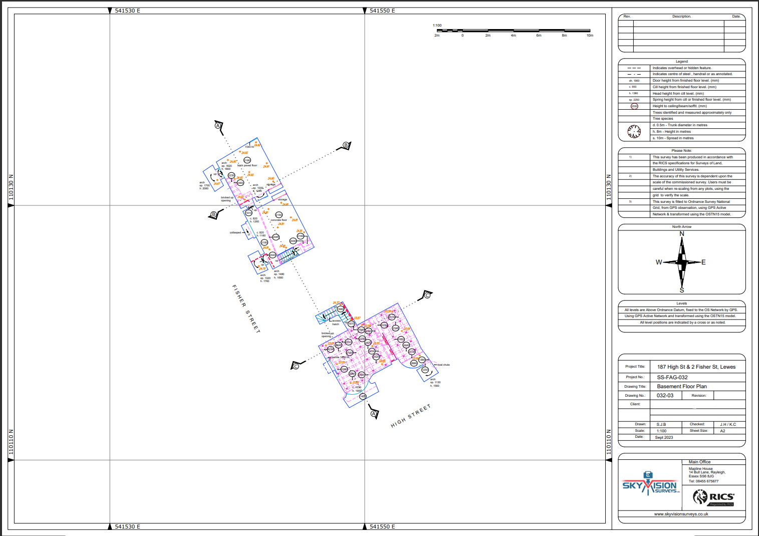

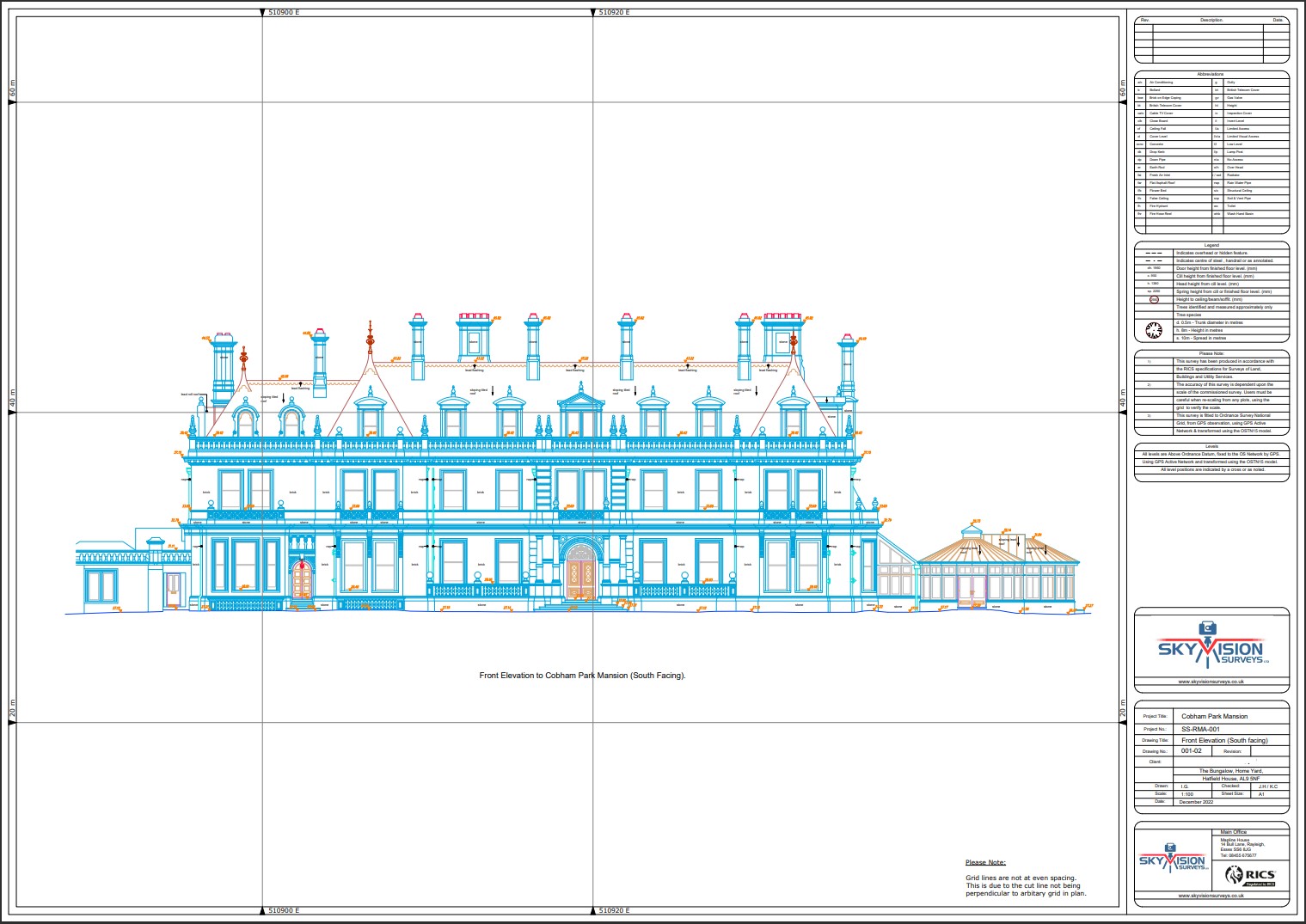


Point Cloud Surveys
Explore Skyvision Surveys’ Point Cloud service, a cutting-edge solution revolutionising surveying practices. We specialise in capturing vast arrays of precise data points using advanced LiDAR and photogrammetry technologies.
Our point cloud surveys deliver highly detailed 3D models, empowering industries across construction, environmental monitoring, and beyond.
Trust Skyvision Surveys to transform raw data into actionable insights, streamlining workflows, and maximising project efficiency. Join the forefront of spatial data innovation with our comprehensive point cloud solutions.
Unsure what services you need?
Feel free to contact the team 0843 378 0353
Our Location
Have Any Questions?
Have Any Questions?
If you have any questions regarding our services feel free to contact the Sky Vision team.